 |
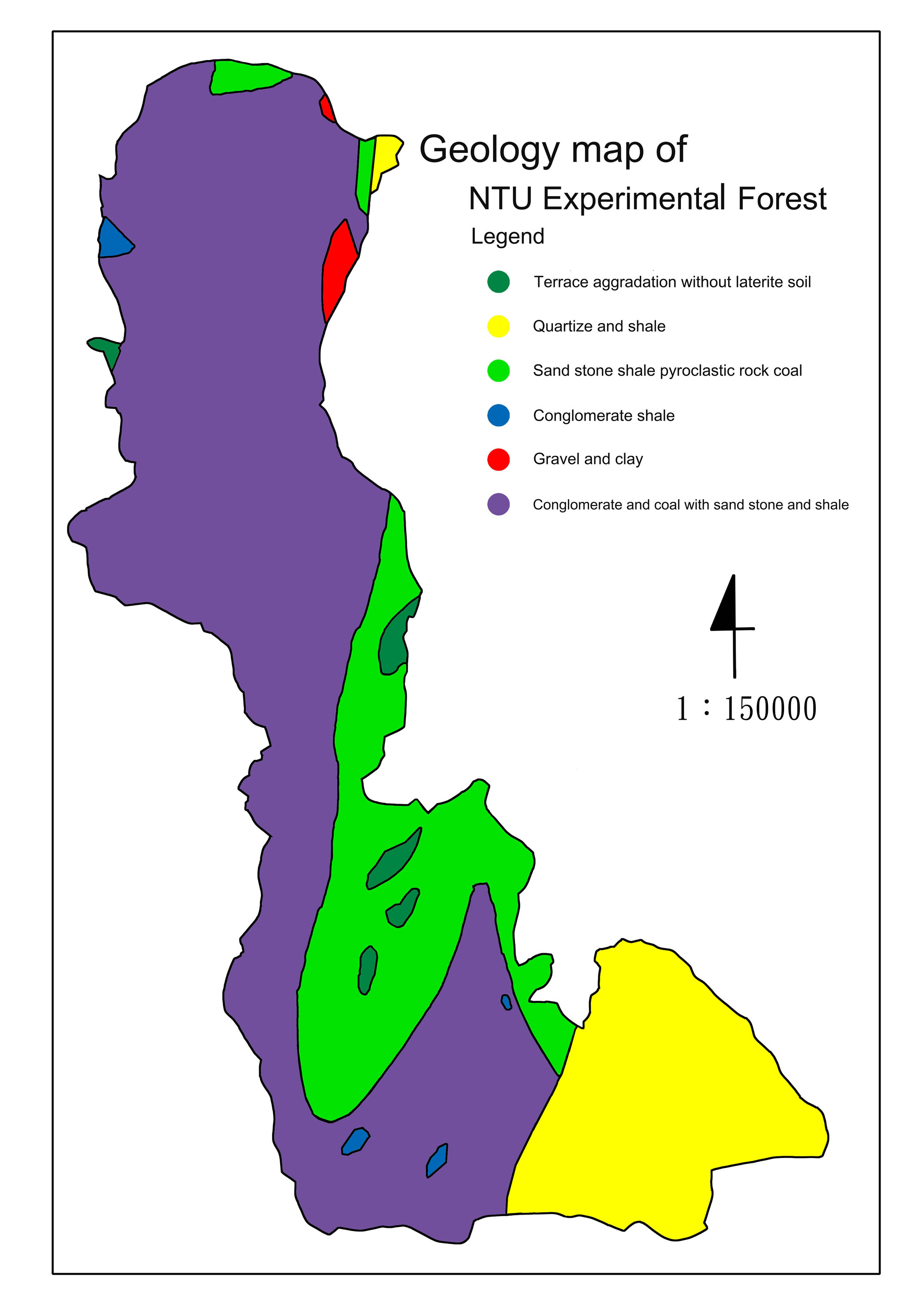
Most rocks underlying the Experimental Forest are from the Tertiary Period with just one section from the Quaternary Diluvial Period. The range of mountains east of the Heshe River, which includes Mt. Morrison (Yushan), and the clay stone area of Mount Dongpu are comprised of Tertiary bedrock that is mostly sandstone. Arenaceous shale is interspersed with layers of sandstone. Developing sandstone forms tend to become conspicuous. Compared to the shale, the sandstone is quite thick. It is also extremely hard and forms rounded boulders. Dislodged by erosion and earthquakes, these giant stones roll down slope and are now widespread. The shale is thin and brittle. It always contains fossil sea life, mostly bivalve mollusks.
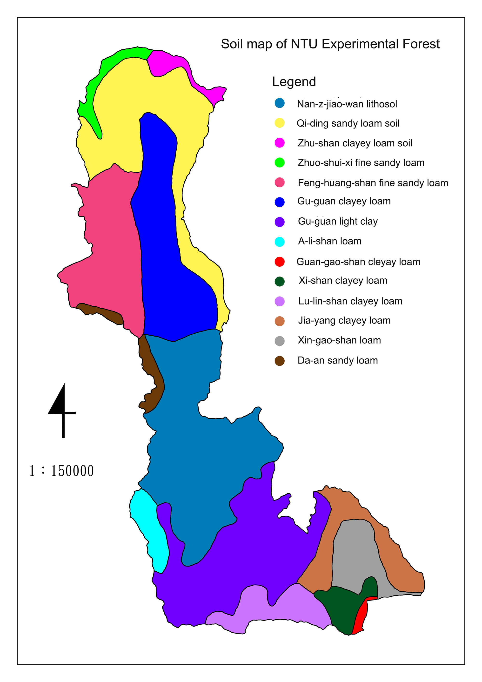 |
The Experimental Forest contains many soil types. The banks of the Zhuoshui River are mostly clay, while the banks of the Peishi River and the Chenyoulan River are mostly sandy soil. The Heshe Tract is mostly gravel. In this treacherous cliff, the soil is shallow, whereas the soil in the gentle sloping areas is deep and rich in humus.