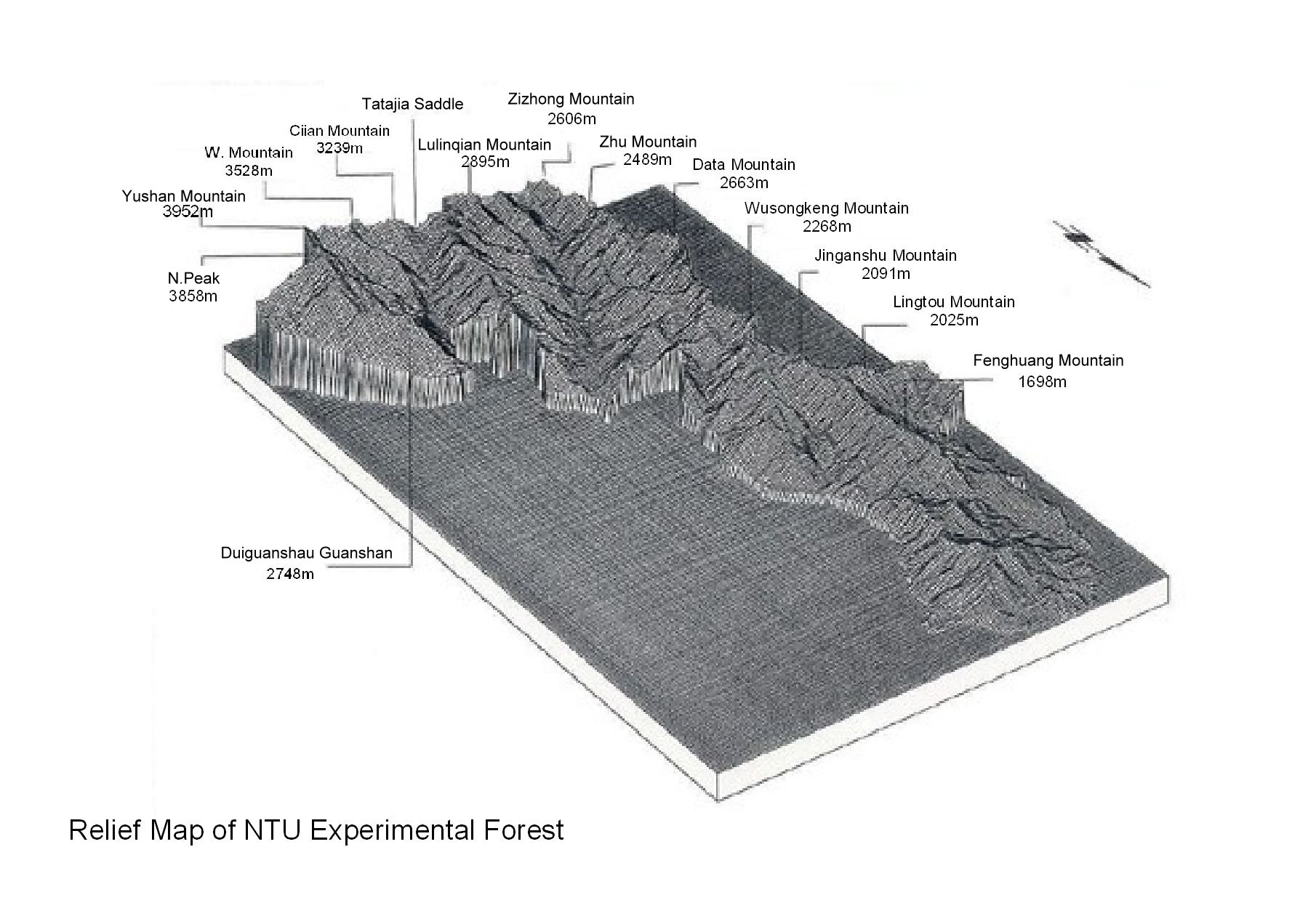
The Experimental Forest is 37 kilometers (km) long from north to south and from 6 to 14 km east to west. The topography varies from lowlands in the north to mountain highlands in the south.Kuei-tzu-tou, on the southern bank of the Zhuoshui River, is the lowest point at 220 meters above sea level (asl). The highest point is the peak of Mount Morrison (or Yushan, which means Jade Mountain in Chinese) at 3,952 meters asl. Thus, the Experimental Forest has an overall elevation range of 3,732 meters. Most of the mountain terrain is steep, except for some gentle slopes at the base of the mountains. The most precipitous terrain is in the south around Mount Morrison and nearby peaks.
 |