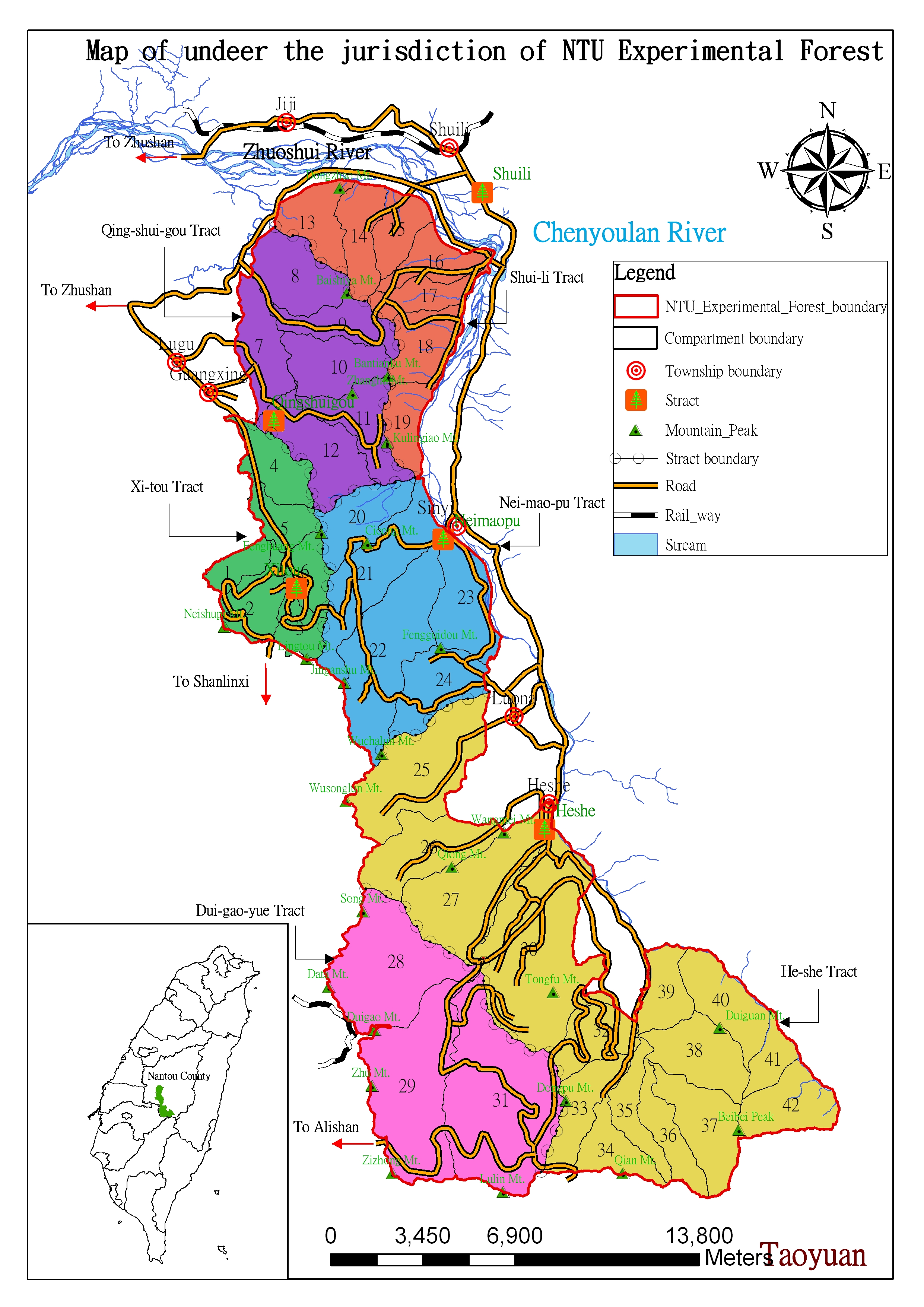
The Experimental Forest extends from 23o28'10" to 23o48'49" North latitude and from 120o45'16" to 120o59'15" East longitude. It covers 32,765.83 ha, about 1% of the total area of Taiwan, and lies within three townships, Xinyi, Shuili, and Luku, in Nantou County, central Taiwan. The Experimental Forest extends from Mount Morrison (Yushan) in the south to the Zhuoshui River in the north. The eastern boundary runs along northern Mount Morrison range, past Batongguan to the Chenyoulan River. The western boundary runs from Mount Zhushan and Mount Data to Mount Wusonglun, Mount Lingtou and Mount Neishupi in the Mount Ali range.
|
|